Introduction about MH370 Malaysia Airlines on Google Maps
The mysterious disappearance of Malaysia Airlines Flight MH370 remains one of the most haunting aviation mysteries of the 21st century. With technology playing an increasingly significant role in global problem-solving, amateur investigators have turned to unconventional tools like Google Maps in their efforts to locate the missing aircraft. Among these digital sleuths, a particular claim involving satellite imagery from Google Maps sparked widespread interest and debate. This article delves deep into the MH370 mystery and explores the intriguing role Google Maps has played in amateur and citizen-led investigations.
MH370 Airline Disappearance and Initial Search
On March 8, 2014, Malaysia Airlines Flight MH370 vanished from radar during its scheduled journey from Kuala Lumpur to Beijing. The aircraft, a Boeing 777 carrying 239 passengers and crew, deviated sharply from its planned route and disappeared somewhere over the Indian Ocean. The initial search efforts involved multiple countries and agencies, covering a vast area spanning both land and sea.
Key facts:
- Last communication: Over the South China Sea, shortly after takeoff.
- Flight deviated from its flight path without explanation.
- Despite extensive air and sea searches, no definitive location of the wreckage was initially identified.
The Contribution of Technology to the Search Efforts
In the aftermath, technology emerged as a critical ally in the search. Advanced underwater drones, oceanic drift analysis, and satellite tracking via Inmarsat helped narrow down possible crash zones. However, the sheer scale and remoteness of the potential search areas presented insurmountable challenges, even for well-equipped national teams.
MH370 Malaysia Airlines on Google Maps
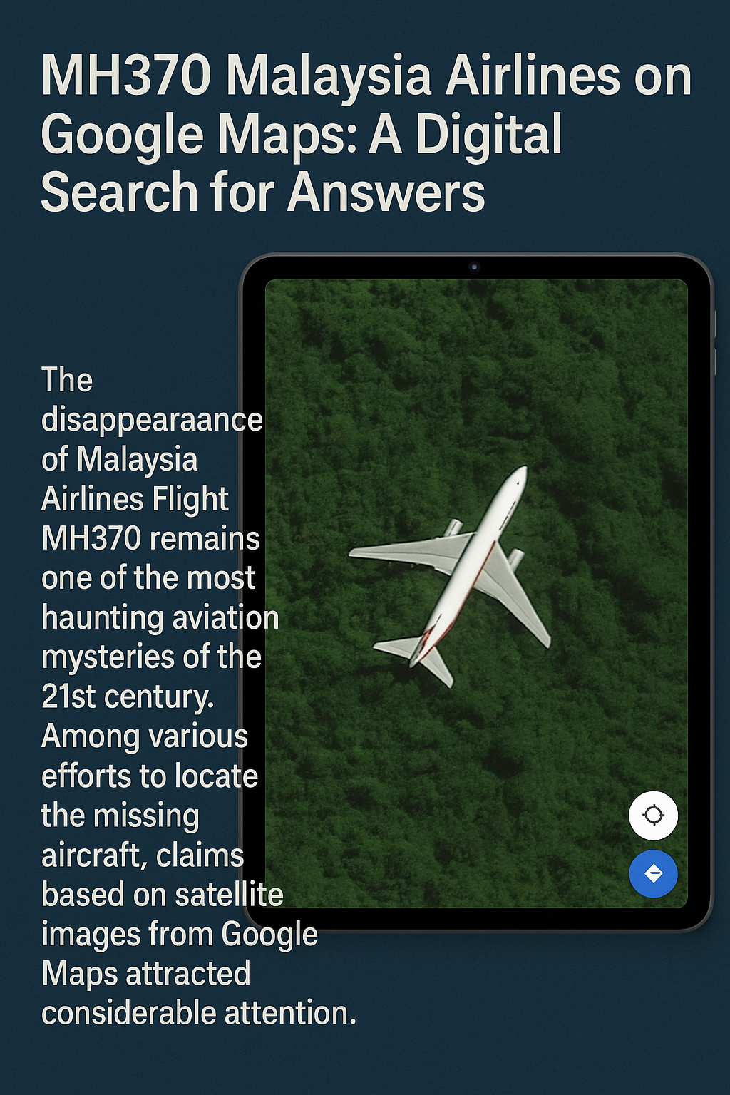
As official searches dragged on with limited success, online communities began their own investigations. Google Maps and Google Earth, with their expansive satellite imaging capabilities, became popular platforms for digital sleuthing. Users started scouring satellite views, hoping to spot unusual shapes, shadows, or outlines that might resemble aircraft wreckage.
The Assertion by Ian Wilson
In 2018, British video producer Ian Wilson claimed to have spotted what he believed to be MH370 on Google Maps. The supposed plane-shaped object was located deep within the Cambodian jungle. Wilson supported his claim with measurements, comparing the object’s dimensions to those of a Boeing 777.
His claim drew massive media attention and led to further speculation. He even attempted a jungle expedition to reach the site, although dense terrain and logistical challenges hindered significant progress.
Evaluation of the Google Maps Assertion
Experts quickly cast doubt on Wilson’s claim. Several critical issues were raised:
- Google Maps satellite images are not live and may be outdated.
- The object might be a conventional aircraft captured in mid-flight.
- Shadow and resolution distortions can make shapes appear misleading.
Despite the skepticism, Wilson’s assertion reignited public interest in MH370 and showcased the power—and limitation—of citizen-led digital efforts.
The Difficulties in Interpreting Satellite Imagery
Satellite imagery, particularly from platforms like Google Maps, presents several interpretational challenges:
- Low-resolution images can distort objects.
- Static images don’t provide temporal context.
- Natural features can mimic man-made structures.
These limitations make it difficult to draw conclusive evidence from such images without corroborating data from other sources such as radar, sonar, or flight path analytics.
The Continuing Search and Prospects Ahead
Even as time progresses, the desire to locate MH370 has not faded. Several nations, private companies, and families of the victims continue to advocate for renewed search efforts. Ocean Infinity, a seabed exploration company, has expressed willingness to undertake new missions using improved AI and underwater scanning technology—if new credible data emerges.
The Influence on Aviation Safety
MH370’s disappearance catalyzed several reforms in aviation monitoring:
- Implementation of global flight tracking every 15 minutes via the ICAO Global Aeronautical Distress and Safety System (GADSS).
- Broader implementation of satellite-enabled ADS-B (Automatic Dependent Surveillance-Broadcast) monitoring systems.
- Improved cockpit communication protocols and black box locator battery lifespans.
The Tragic Aspects of the MH370 Incident
Beyond the technological and investigational discussions lies a deeply human tragedy. The 239 lives lost represent families torn apart and years of emotional turmoil.
- Loved ones of the passengers have endured years of uncertainty.
- Memorials have been established in Malaysia, Australia, and China.
- The incident raised urgent questions about transparency and crisis management in global aviation.
The Involvement of Citizen Investigators
The case of MH370 also saw an unprecedented rise in online sleuths and digital volunteers:
- Independent analysts studied flight data, ocean currents, and weather patterns.
- Communities compiled theories and leads from across the globe.
- Google Maps became a favored tool for scouring remote terrains.
However, the lack of scientific methodology in many of these investigations often led to speculative conclusions.
The Necessity of Scientific Rigor
While citizen involvement has value, experts emphasize the need for evidence-based, scientific approaches in aviation investigations. Search operations must be guided by verified data, not anecdotal or speculative claims, especially when resources and time are critically constrained.
The Future of Aircraft Tracking
MH370 prompted global discussions on how aircraft should be tracked moving forward:
- Airlines now must report location at regular intervals.
- New aircraft are equipped with more advanced emergency locator transmitters (ELTs).
- Discussions continue around deploying real-time black box data streaming.
The Role of Social Media in Information Dissemination
Social media platforms played a massive role in keeping MH370 in the public consciousness:
- Hashtags like #MH370 trended globally.
- Facebook groups and Twitter threads became hubs for updates and theories.
- Emotional outpourings and solidarity movements formed online communities for the families of victims.
MH370 via Google Maps: Reddit’s Crowdsourced Investigation
Reddit also became a breeding ground for MH370 investigations. A subreddit dedicated to the mystery saw users share imagery, discuss radar anomalies, and assess plausible crash theories. While some posts veered into conspiracy, others contributed thoughtful and well-sourced content.
Reddit’s Participation
Redditors helped amplify Wilson’s Google Maps claims and dissected every pixel of satellite images. Some even crowd-sourced funds for independent investigations. This collaborative model demonstrated how modern digital communities could support—or sometimes derail—complex search efforts.
The Psychological Effects of Uncertainty
Perhaps the most haunting aspect of MH370’s disappearance is the psychological burden of uncertainty. For many families:
- Closure remains elusive.
- Grief is complicated by the absence of physical evidence.
- Every new theory—plausible or not—reopens emotional wounds.
Psychologists stress the importance of mental health support for victims’ families, especially in unresolved tragedies.
Conclusion
The MH370 tragedy is a sobering reminder of the limits of technology, the vulnerabilities of modern aviation, and the enduring strength of human curiosity and compassion. While Google Maps and other digital platforms have brought attention to new angles and theories, the mystery remains officially unsolved. Yet, in the face of tragedy, a global community—spanning scientists, investigators, digital volunteers, and grieving families—continues to seek the truth.